As winter approaches, New Jersey finds itself once again preparing for an early snowfall event. The latest updates from meteorologists suggest that snowfall estimates have increased, indicating that what was initially expected to be a minor dusting could turn into a more significant weather event for the state. This unexpected development has caught the attention of local communities, prompting urgent preparations to mitigate any potential disruptions the storm might bring.
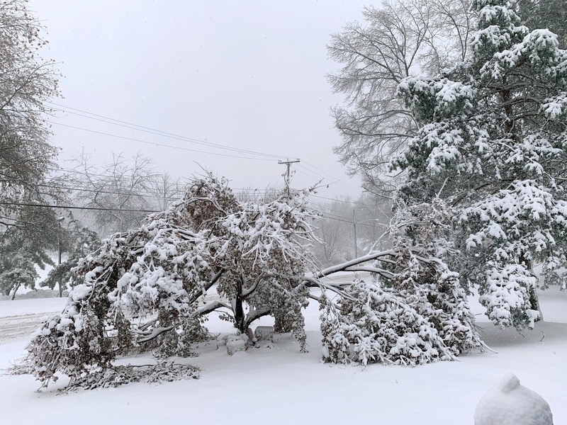
The storm is forecasted to move across New Jersey overnight, with snow expected to accumulate in various regions. Forecasters are now predicting a range of accumulations, from a light coating up to a few inches, with certain areas potentially receiving even more. Residents in higher elevation areas should remain particularly vigilant, as these zones are likely to experience the most substantial snowfall.
This shift in weather conditions calls for New Jersey residents to stay informed and act accordingly. Local authorities are advising people to take the necessary precautions, such as ensuring vehicles are winter-ready and stocking up on essential supplies. The timing of this storm means that the morning commute could be challenging, with snow and possibly icy roads creating hazardous conditions.
Schools and businesses across the state are also preparing for the impact. Administrators are reviewing their inclement weather policies, considering whether closures or delayed openings might be necessary to ensure the safety of students and employees. Meanwhile, road crews are on standby, ready to deploy plows and salt spreaders once the snow begins to fall.
Social media platforms are buzzing with updates and advice. The National Weather Service continues to issue alerts and provide real-time updates, ensuring that the public has access to the latest information. Local news outlets and weather stations are also playing a crucial role in disseminating timely updates and safety tips.
For those wanting to stay updated, Cherry Hill News Today offers comprehensive coverage of the unfolding weather situation. You can follow their updates and join the conversation on their [Facebook](https://www.facebook.com/profile.php?id=61561607604274) and [Twitter](https://x.com/cherryhillnt) pages. These platforms will keep you informed about road conditions, school closures, and any changes in the storm’s path.
As the state braces for this early taste of winter, it’s essential for residents to stay proactive. Listening to weather forecasts, preparing for potential delays, and ensuring that homes and vehicles are ready for winter conditions can make all the difference. While the snowfall may not be record-breaking, it’s the first of the season and serves as a reminder of the importance of preparedness in dealing with the challenges of winter weather.
In summary, New Jersey’s weather watchers are keeping a close eye on an overnight storm that promises to bring increased snowfall to the region. Although this isn’t the blizzard of the century, the sudden change in snowfall projections underlines the unpredictable nature of weather patterns. By staying informed and prepared, residents can ensure their safety and minimize disruptions. As the snowflakes begin to fall, stay connected with Cherry Hill News Today’s [Facebook](https://www.facebook.com/profile.php?id=61561607604274) and [Twitter](https://x.com/cherryhillnt) for all the latest developments and community updates.