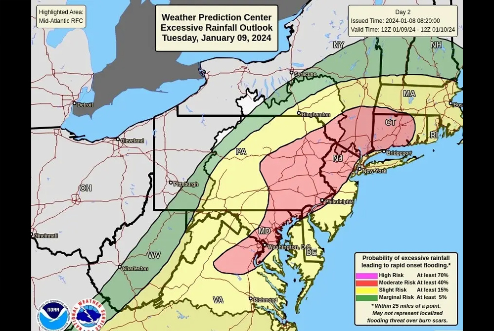
Cherry Hill faces potential dangers on Tuesday night, with a midweek storm forecasted to bring heavy rain and gusty winds, impacting travel and posing flooding risks into Wednesday. The National Weather Service (NWS) indicates a “moderate risk” of excessive rainfall that could lead to rapid-onset flooding.
Forecasters expect the storm’s impact to intensify Tuesday night, creating additional risks for drivers navigating in the dark. Jon Porter, AccuWeather’s chief meteorologist, warns of difficulties for commuters in the I-95 corridor due to flooding, downed trees, and power lines blocking roads on Wednesday morning.
The NWS predicts 1-3 inches of rain from Tuesday through early Wednesday, heightening flood risks in urban settings and areas near bodies of water, particularly during the heaviest rain Tuesday night.
As of Monday, the NWS has issued two flood watches for Cherry Hill and surrounding areas:
- A flood watch in effect from 1 p.m. Tuesday through 6 p.m. Wednesday, anticipating “excessive” rainfall during this period.
- A coastal flood watch from 9 p.m. Tuesday to 4 a.m. Wednesday, indicating potential inundation of 1-2 feet in areas near shorelines and tidal waterways, including the Delaware River. Minor damage to vulnerable structures is possible.
Inland gusts are expected to reach 40-50 mph, peaking Tuesday night, while coastal areas may experience gusts up to 65 mph. The NWS advises that damaging winds are less likely further inland, with Camden County under a wind advisory from 5 p.m. Tuesday to 3 a.m. Wednesday. During this time, gusts could lead to unsecured objects being blown around and tree limbs snapping, potentially causing a few power outages.
Residents are urged to stay updated on weather developments and take necessary precautions to ensure their safety during the approaching storm.